A virtual laser scanning simulator for education & research
An Unreal Engine–based platform for simulating terrestrial and mobile laser scanning. Plan stations and export realistic point clouds — without any physical hardware.
About
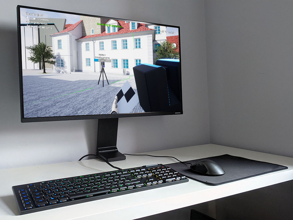
A complete scanning workflow, simulated in 3D
VRscan3D is a terrestrial laser scanning simulator developed within an international project funded by DAAD. Students and professionals practise scanning workflows, plan station placement and export realistic point-cloud data — all in a virtual environment.
◆Simulates the full TLS workflow — from planning to data export
◆Eliminates the need for physical scanners in classroom training
◆Creates realistic scan data with noise, intensity and material reflections
Capabilities
Everything you need to teach real scanning
{{ t.glyph }}
{{ t.kind }}
{{ t.title }}
{{ t.desc }}
What makes it unique
The features that set VRscan3D apart
{{ activeMode.title }}
{{ activeMode.desc }}
▹{{ b }}
Research
Scientific publications
Peer-reviewed work on the concept, development and evaluation of VRscan3D. Click any entry to read the abstract.
Recognition
Internationally awarded
The team
Researchers behind VRscan3D


Try it free
Start scanning in the virtual world
Download VRscan3D for free
✉
Email
info@vrscan3d.com
▶
Demo
Watch on YouTube